ESCAROUPIM NATIONAL FOREST
Distance: 8.5 km; Duration: 3h;
Degree of Difficulty: Very Easy
Trail departure point: Largo dos Avieiros – near the Tagus River
Coordinates: 39.066673, -8.756951
This trail lets you discover two of the region’shallmarks. The fishing village of Escaroupim is part of our forest heritage represented in the National Forest. On this trail it is easy to park your car and restaurant service is readily available.
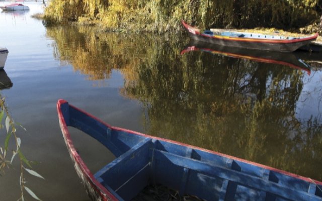
This itinerary begins near the banks of the Tagus River and affords an extensive view of the water, Garças Island and the village of Valada located on the other shore. Take some time to get to know this fishing village with its houses and boats painted in bright colours.
Start the walk by leaving the riverfront behind and going along the asphalt road that crosses through the cluster of houses for about 300 metres; when you reach the junction at the edge of town, turn left and keep going for another 700 metres until you reach the end of the asphalt road. Turn left here and about 20 metres along this dirt road, you will find a small wooden bridge on your right-hand side.
Here you have the beginning of the section inside theNational Forest. This place is constantly under surveillance and it is expressly forbidden to smoke or light fires here.The forest is divided into plots that are separated by narrow paths or broad firebreaks. For your safety, always stay on the marked paths and obey the signs.
This forest, initially known as the Pinhal de Escarópim (Escarópim Pine Forest), was administered by the Royal Hunting Establishment until 7 April 1836, when it was incorporated into the General Administration of the Kingdom’s Forests. Since then it has been owned by the State. The original clusters of maritime pine (Pinus pinaster) and stone pine (Pinus pinea), were converted into eucalyptus clusters starting in 1907 and, during World War II, they became an important source of fuel for the railway locomotives that passed just a few kilometres away across the Rainha D. Amelia Railway Bridge.
After crossing the wooden bridge, follow the path in a straight line for 400 metres until you reach a sandy road. Here, at the end of the stone pine cluster, the Arboreto begins. From the Latin arboretum, it is an area that functions as a botanical garden with a collection of scientifically documented and ordered trees. Here you will find 125 of the more than 700 species of eucalyptus that exist in the world. Tall trees with an active, pleasant and balsamic scent, they are known for their significant regeneration and diverse morphology. In general, they are used as raw material for the pulp and wood industry and also for their essential oils for the pharmaceutical and perfume industries. An interesting fact is that Lisbon Zoo’s koalas are fed with leaves from this place. Keep going straight ahead and enter this little-known world.
Here, the trail consists of four straight segments that, at the end, lead to a wide road. The first segment is 300 metres long and has the characteristic intense citric scent of the Eucaliptus citriodora, which because of its high citronella content is of interest to the perfume industry, as it is extracted and used in soaps and perfumes or in outdoor candles.
Next, turn right and go along for 100 metres, turn left and go along for another 100 metres where you will find the Eucaliptus cinerea, which has the unique characteristic of having leaves in even numbers. When a stem has an even number of leaflets on it, this is referred to as paripinnate. Next is an unmistakeable species due to its imposing size, namely the Eucaliptus saligna, a vigorous species that can reach a height of 50 metres. Here, turn left and keep going straight ahead for 200 metres; at the end, on the right side, you can see some trees with thick and wrinkly bark very similar to the cork of cork oaks. They are also eucalyptus trees. During their evolutionary process, the urophylla, robusta and botryoides species developed this bark to protect themselves from fires and significant temperature ranges.
Cross the road and keep going straight ahead for 1,900 metres, with a cluster of pine trees on your right in various phases of growth, while on the left you have various open fields used for agricultural testing. After passing the research centre, keep going for another 300 metres, immersed in a dense cluster of maritime pine some 30 years old and then turn left. Continue for about 500 metres, turning left again; 300 metres farther on turn right and keep going for another 300 metres, ending here, in the middle of young pine trees, the observation of the various species that are studied at this research site.
At the end of the pine cluster, turn left and keep going ahead for 1,300 metres, keeping the forest on your left and the Muge Brook, which flows into the Tagus near Escaroupim, on your right. When you reach the campsite, take the time to enter and admire the monumental stone pine trees that are over 300 years old and are part of the primitive forest of the region. As you leave the park, turn right and keep going straight ahead for another 500 metres; this will bring you to the start of the asphalt road that takes you back to the starting point.


